Fun with Maps

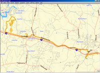
Does anyone else love maps? I can't get enough of them. I have all kinds of paper ones, but use the ADC and DeLorme Gazetteers most, with a few USGS Quads thrown in, and lots of small venue maps, like those of various parks. For my GPS I can choose between DeLorme Topo USA, and Magellan's Mapsend Topo/Streets Products. I have tracked most of my rides into the Magellan product because it is the easiest and quickest to use for my purposes. I download the track, name it and take a screenshot of the map and profile for use in the pages. How about on line? I have looked at Topofusion a bit and like it, but use Google Maps more. Google maps covers the US and Canada, Great Britain, and Japan. I like Streetmap.co.uk because at the most detailed level they use Ordnance Survey Maps, the best looking maps in the world. Of course, I only go to the UK in my dreams. What is you favorite online mapping resource? What is best for Italy? Germany? France?
I ask because I'm looking at different options for displaying maps in my ride journals. There are a couple of Japanese sites which have interesting mapping. I am usign them for examples because I'm not familiar with any examples in english. If you know of any, let me know.
I like the 3-D aspect of this one: High ground Net. Pick any of the tours and scroll down to see the neat detail.
How about Camepota.Net? Here a master map links to sub maps with areas highlighted, which in turn link to ride reports. The maps in the ride reports have the photos linked from the map as well as in the text.
Here is a final Japanese example: Cyber Cyclist's Home Page. This site uses a Google Maps API to link points to pictures.
I found an online product which will produce the code to do this for me, MapBuilder.net, and I'm playing with the tools now. You can link photos into the marker descriptions. I'll be playing with the photo formatting to get a good size to link to from the thumbnails. I also need to find a good way to mark the actual routes with a "polyline." Here is my report from Jan 10 in the way I've been doing reports so far. Compare to the same report using the new tools. The blue section is a test of route marking using polylines. Each marker has a photo, but only one is links to a larger vesion. To get the markers to line up correctly I use the time the picture was taken as the title. What I like about this setup is being able to zoom in or out, a feature sorely lacking in my current map graphics. I should also be able to do a county overview map linking to each ride. Take a look and let me know what you think.


2 Comments:
Don't you think you are making it far too easy on you stalkers?
Hmm, my stalkers? They're doing a good job being discreet so far. If they can't find me with a name and a link to google, the stuff I add here won't help them.
Post a Comment
<< Home